Aviation Terminology
| Term | Definition | |
|---|---|---|
| Horizontal Surface | The plane 150’ above the established ARP for utility or visual runway surface extends 5000’ all others 10,000’ | |
| Conical Surface | Extends 4000’ past where the horizontal surface ends – slope is 20/1 – every 20 ‘ in horizontal surface distance increases in height by 1’. | |
| Transitional Surface | Connects obstacle surfaces together -- connects approach surface to horizontal and conical. | |
| Runway Types | Visual - No instrumental procedures – intended solely for aircraft using visual approach procedures w/no straight-in instrument approach procedures (existing or planned) | |
| Non-Precision Instrument - Runway has an existing or planned instrument approach procedure utilizing air navigation facilities with only horizontal guidance or area type navigational equipment (VOR, NDB, GPS) Straight-in only. | ||
| Precision - Has existing or planned instrument approach procedure utilizing an ILS, MLS or PAR. Horizontal & vertical guidance. | ||
| Types of VORs | VOR - Basic Navigational facility provides lateral information signals | |
| VOR/DME - Lateral information and distance (DME) straight line distance from station | ||
| TACAN - Tactical Air Navigation – used by military – requires airborne military TACAN receivers | ||
| Slopes | 50/1 Precision | |
| 34/1 Non-Precision | ||
| 20/1 Conical | ||
| Localizer | A localizer is one component of an ILS or Instrument Landing System. The localizer usually provides runway centerline guidance to aircraft. In some cases a localizer is at an angle to the runway usually due to obstructions around the airport. Localizers also exist in stand-alone instrument approach installations and are not always part of an ILS or Instrument Landing System. | 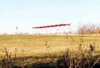 |
| ASDE | Airport Surface Detection Equipment-- enables air traffic controllers to detect potential runway conflicts by providing detailed coverage of movement on runways and taxiways, by collecting data from a variety of sources. | 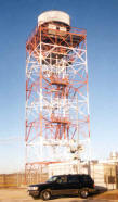 |
| RTR | Remote Transmitter/Receiver | 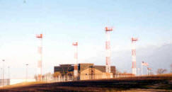 |
| ASR | Airport surveillance radar systems are capable of reliably detecting and tracking aircraft at altitudes below 25,000 feet (7,620 meters) and within 40 to 60 nautical miles (75 to 110 km) of their airport. | 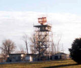 |
| VOR/VORTAC VOR/DME | A ground radio station consisting of a collocated very-high-frequency Omnidirectional radio range (VOR) and TACAN facility; this station permits obtaining polar coordinates by the use of VOR receiver and distance-measuring equipment, or by TACAN equipment alone. | 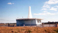 |